Many families worry about hurricane damage and how to stay safe during the Atlantic hurricane season. The National Hurricane Center reports that hurricanes cause billions in property damage each year.
This guide will show you the most reliable hurricane tracker tools to help protect your home, make smart plans, and file insurance claims with confidence. Find out which tools experts use before the next tropical storm arrives.
Key Takeaways
- Hurricane tracker tools like NOAA’s National Hurricane Center, AccuWeather, and My Hurricane Tracker give real-time data on storm paths, wind speeds, and storm surges. These help families and public adjusters stay safe and make quick decisions during hurricane season.
- Interactive maps and apps use official data from sources like NOAA and the National Weather Service. They display flood zones, color-coded hurricane categories (based on the Saffir-Simpson scale), and send alerts for homes in risky areas.
- Public adjusters use tools with satellite images, radar overlays, and computer models to assess property damage faster and more accurately. This helps with insurance claims and fair settlements after storms.
- Homeowners insurance often covers wind and rain damage from hurricanes but not flood damage. Separate flood insurance is needed for protection in flood zones, as most standard policies do not include this.
- Mobile apps like The Weather Channel App and FEMA App provide quick alerts and tips. They help families plan evacuation routes, create emergency kits with non-perishable food, and protect their homes before a hurricane hits.
Understanding Hurricane Trackers
Hurricane trackers are tools that help us follow storms. They provide real-time information about wind speed, storm paths, and potential damage.
The Role of Hurricane Trackers for Public Adjusters
Public adjusters use hurricane tracking tools to track severe weather and tropical hurricanes in real time. These trackers help adjusters forecast the storm path, monitor wind speeds, and watch for changes in the Saffir-Simpson scale.
By checking data from the National Hurricane Center, NOAA, and doppler radar, they can watch for hurricane warnings and storm surges. This information helps with fast damage assessment right after the hurricane passes.
Accurate maps and updates give public adjusters key facts about property damage in high-risk flood zones or coastal areas during the Atlantic hurricane season. With this real-time data, an insurance adjuster can plan site visits, talk to homeowners about potential claims, and gather proof of hidden damage.
Tools like interactive maps and satellite imagery support fair insurance settlements by showing clear pictures of affected homes or neighborhoods. These details also help adjusters advise on risk management before storms hit, helping policy holders get ready faster and make better use of their homeowners insurance or flood insurance policies.
Key Features of Reliable Hurricane Tracker Tools
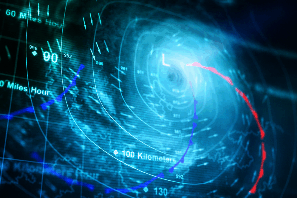
Reliable hurricane tracker tools use real-time data from NOAA, the National Weather Service, and the National Hurricane Center. These tools give accurate storm paths, storm surge alerts, and wind speed updates.
They display color-coded maps that show hurricane categories using the Saffir-Simpson scale. Many hurricane tracking apps, like My Hurricane Tracker, also send push alerts for warnings and watches in specific flood zones.
Interactive hurricane maps help you see predicted storm tracks and the cone of uncertainty. Some platforms, such as the AccuWeather Hurricane Tracker, use computer models and composite radar to simulate wind speeds and storm surge.
Many tools include updates from hurricane hunters and aircraft reconnaissance for more precise damage assessment.
Stay informed with official sources for safety during tropical storms.
Next, learn about top hurricane tracker tools and websites that many families trust for property damage and disaster response.
Top Hurricane Tracker Tools and Websites
The right tools help you track hurricanes better. Some top websites give real-time updates on storms and their paths.
NOAA National Hurricane Center
NOAA National Hurricane Center (NHC) shares the most up-to-date hurricane tracking data for the Atlantic hurricane season and eastern Pacific basins. Meteorologists at NHC use radar, satellite imagery, and computer models to track tropical storms and hurricanes.
They post hurricane warnings and watches, maps, and real-time updates that help public adjusters, insurance companies, and families prepare for property damage and storm surge.
NHC uses the Saffir-Simpson scale to rate hurricane strength, which helps homeowners know the risk level. Storm-chasers, insurance adjusters, and emergency management teams rely on NHC data to make quick safety decisions.
You can check their website for hurricane tracking tools, forecast maps, wind speed probability, and information on flood zones. Families in flood-prone areas should use these updates to plan evacuation routes, prepare emergency kits, and protect their homes before a hurricane hits.
Live Hurricane Tracker Tools
Live hurricane tracker tools provide real-time updates about storms. These tools help homeowners stay informed during hurricane season. Most reliable trackers show storm paths and wind speeds.
They also include features like satellite images and radar data.
The National Hurricane Center offers a trusted platform for storm tracking. Other apps like My Hurricane Tracker and AccuWeather keep users updated on changing conditions. Knowing the location of a storm helps families plan their safety measures, such as evacuation routes or emergency kits filled with non-perishable food.
Stay alert, stay safe.
Interactive Hurricane Maps
Live hurricane tracker tools provide real-time updates. Interactive hurricane maps take this a step further. They show detailed paths of storms and their potential impacts. Homeowners can see how close a storm is to their area.
These maps often use colors, symbols, and lines to display information. For example, you might see areas at risk for flooding or storm surge. Tools from the NOAA National Hurricane Center are among the best for accuracy.
Maps help families evaluate evacuation routes too.
Using interactive features allows users to zoom in on specific locations. This helps assess flood zones or property damage risks better. Keeping an eye on these maps is smart during the Atlantic hurricane season when storms can develop quickly.
AccuWeather Hurricane Tracker
AccuWeather Hurricane Tracker offers real-time updates on storms. It provides detailed forecasts and alerts for homeowners in hurricane-prone areas. This tool shows the path of hurricanes, wind speed, and storm surge information.
Users can access maps that highlight flood zones and potential risks.
The tracker is user-friendly, making it easy to stay informed during the Atlantic hurricane season. Families can plan evacuation routes based on accurate data. With this tool, you will find crucial insights into weather systems and how they affect your property insurance claims process.
Clime: NOAA Weather Radar Live
Clime offers NOAA Weather Radar Live. This tool helps track hurricanes in real-time. Homeowners can see storm paths and monitor severe weather alerts easily. Clime’s radar shows rain, wind speed, and more.
The app is user-friendly. It provides updates on hurricane damage potential too. Families can use it to make smart decisions during storm season. Having accurate data improves safety and preparation before a hurricane hits your area.
Weather Underground Hurricane Tracker
Weather Underground Hurricane Tracker provides real-time information on storms. Homeowners can access detailed maps and forecasts. This tool helps families prepare for hurricanes, like Hurricane Ian and Hurricane Helene.
It uses data from the National Oceanic and Atmospheric Administration (NOAA) to give accurate updates.
Users can track changes in storm paths easily. Alerts are sent out when conditions change or new storms form. The app covers important details such as wind speed, flood zones, and storm surge predictions.
Using Weather Underground, you stay informed during hurricane season and enhance your safety measures at home.
Satellite and Radar Technology in Hurricane Tracking
Satellite technology helps track storms from space. Radar shows real-time images of a hurricane’s progress.
Satellite Imagery for Storm Monitoring
Satellite images play a key role in storm monitoring. They give clear views of hurricanes from space. This helps meteorologists track storms as they develop. Homeowners can see the size and movement of these storms.
Monitoring images helps assess potential damage to property. You can watch for changes in hurricane strength using these tools. Satellite imagery is essential for understanding how close a storm may come to your area.
Reliable updates allow families to prepare early, ensuring their safety during the Atlantic hurricane season.
Radar Overlay for Real-Time Updates
Radar overlays provide real-time updates on storms. These tools show where a hurricane is and how it moves. Homeowners can see the storm’s strength using radar data. It helps in making quick decisions, like when to evacuate.
Public adjusters benefit from accurate radar overlays too. They use this information for damage assessment after a storm hits. Knowing the exact location and speed of a hurricane aids in filing claims with insurance companies.
Tools such as NOAA and live hurricane trackers offer valuable insights during storm seasons, including details about flood zones and wind speed probabilities.
Advanced Forecasting Tools
Advanced forecasting tools help predict the path of hurricanes. They use computer models and maps to show wind speeds and storm surges. This information helps people prepare better for storms.
Computer Models and Predicted Storm Paths
Computer models help predict storm paths for hurricanes. These tools use data from satellites, weather stations, and radar. They show where a hurricane might go and how strong it could become.
The National Hurricane Center uses these models to update the public on storm forecasts.
Understanding predicted storm paths is vital for homeowners. This information can guide decisions about evacuation routes and preparing property for potential hurricane damage. Public adjusters also rely on this data to assess risk and file claims accurately.
By following these predictions closely, families in hurricane-prone areas can better protect themselves during the Atlantic hurricane season.
Wind Speed Probability Maps
Wind speed probability maps show how likely strong winds will hit a specific area. These maps help homeowners in hurricane-prone areas understand potential wind damage from storms.
Each color on the map indicates different levels of wind speeds. A dark red zone may face dangerous winds over 100 mph, while lighter colors indicate lower speeds.
These tools are essential for public adjusters and families preparing for hurricanes. They provide important data on storm risk and help assess property damage before it happens. Tracking these probabilities is crucial to making informed decisions about safety and insurance coverage during hurricane season.
Storm Surge Prediction Tools
Storm surge prediction tools help homeowners understand the impact of rising water during a hurricane. These tools provide valuable data about storm surges, which can flood low-lying areas and cause severe damage to properties.
By using reliable sources like NOAA (National Oceanic and Atmospheric Administration), you can access real-time information on potential flooding. These forecasts show areas at risk from storm surges and help families plan for possible evacuations.
Knowing the expected water levels aids in making informed decisions during hurricane season. Make sure to keep updated with accurate predictions to protect your property effectively.
Mobile Apps for Hurricane Tracking
Mobile apps for hurricane tracking offer quick updates and alerts. Apps like My Hurricane Tracker and The Weather Channel App provide real-time data right to your phone. You can stay informed about storms anytime, anywhere.
These tools help you plan and prepare effectively. Explore how these apps can keep you safe during hurricane season!
My Hurricane Tracker & Alerts
My Hurricane Tracker & Alerts offers valuable tools for homeowners in hurricane-prone areas. You can get real-time alerts straight to your phone or tablet. This app helps you stay updated on storm paths and potential threats.
It uses data from reliable sources like NOAA and the National Weather Service.
The tracker gives clear information about storm categories, including the Saffir-Simpson scale. You’ll see updates on wind speeds and possible storm surges, which help with property damage forecasts.
Users can create alert settings based on their location, making it easier to prepare for any threat during the Atlantic hurricane season. Having this tool ensures you are ready when a hurricane approaches, allowing time to secure your home or evacuate if needed.
Hurricane Tracker by EZ Apps
Hurricane Tracker by EZ Apps gives you the latest storm updates. This app helps homeowners stay safe during hurricane season. It provides real-time alerts and tracking for storms like Hurricane Helene.
Users can see detailed maps to understand the storm’s path.
The app also shows evacuation routes and flood zones. You can plan ahead using this information. Non-perishable food items are vital during a hurricane, and this tracker keeps you informed so you can prepare your emergency kits early.
Public adjusters use tools like these to assess property damage quickly after a storm hits.
The Weather Channel App
The Weather Channel App gives users essential storm updates. It provides radar maps and alerts for hurricane tracking. Homeowners can see real-time data on Hurricane Helene or any other storms.
The app helps plan evacuation routes and prepares families for possible property damage. Users get notifications about changing weather conditions, which is crucial during the Atlantic hurricane season.
This app also covers vital topics such as the Saffir-Simpson scale and storm surge predictions. It ensures that users stay informed of flood zones and risks in their area. Next, let’s explore social media’s role in keeping you updated with hurricane alerts.
FEMA App for Emergency Updates
The FEMA app helps you stay informed during emergencies. It gives real-time updates on hurricanes and other disasters. You can get alerts for your area and see safety tips. This tool is vital for families in hurricane-prone areas.
Use the app to find emergency contacts quickly. It also shows evacuation routes, which are crucial when a storm approaches. Store lists of non-perishable food and supplies within the app for easy access.
The FEMA app makes preparing for hurricanes easier and safer while keeping you connected to vital information during storms.
Social Media and Hurricane Alerts
Social media gives quick updates during hurricanes. You can follow local weather services for alerts and important news.
Twitter for Real-Time Storm Alerts
Twitter is a great tool for real-time storm alerts. Many local National Weather Service (NWS) accounts share updates on hurricanes and severe weather. You can follow these accounts to get instant news about storms, warnings, and safety tips.
Public adjusters also use Twitter to stay informed. They can share important information about hurricane damage and recovery efforts. Following trusted sources will help you prepare for the Atlantic hurricane season.
Keep your family safe by staying updated through reliable Twitter feeds during a storm.
Using Local NWS Briefings on Social Platforms
Local NWS briefings are vital during a hurricane. They provide timely updates on storm paths and impacts. These briefings keep homeowners in hurricane-prone areas informed. Check local social media accounts for alerts and information from the National Weather Service.
This quick access helps families make safe decisions.
Monitor these platforms closely to catch real-time updates. Use them alongside reliable hurricane tracking tools for better preparation and safety planning as storms approach.
How to Use Hurricane Tracker Tools Effectively
To use hurricane tracker tools well, start by reading tracking charts carefully. Keep an eye on updates and alerts to stay informed about changes in the storm’s path and strength.
Interpreting Tracking Charts
Tracking charts show the path of a hurricane. They help you understand where the storm will go and how strong it is. Look for important details like the storm’s center, wind speed, and expected landfall time.
Charts often use symbols to mark different data points. These can include categories on the Saffir-Simpson scale, which rates hurricane strength from one to five. You can see if your area falls in a flood zone or faces heavy winds.
This information helps homeowners make better decisions about safety and property damage risks during storms.
Monitoring Updates and Alerts
Stay informed about the latest hurricane updates and alerts. Use tools like NOAA’s National Hurricane Center for real-time information. These trackers show storm paths, wind speed, and potential impacts on your area.
Set up notifications on apps like My Hurricane Tracker & Alerts or The Weather Channel App. They provide warnings straight to your phone. Check social media, too; Twitter is a great source for immediate alerts from local weather services.
Accessing this data can help you assess risks and prepare effectively for any upcoming storms.
Leveraging Historical Data for Risk Assessment
Historical data helps homeowners understand the risks they face from hurricanes. Past storms can show patterns in hurricane damage, allowing families to see which areas might be most affected.
Using this information, property owners can assess flood risk and prepare better.
Data also aids public adjusters in their work. They analyze previous claims related to hurricanes. This analysis informs insurance policies and settlements for future events. By focusing on hidden damage caused by past storms, it becomes easier to secure fair settlements with insurance companies during a hurricane season like the Atlantic hurricane season.
Preparing for a Hurricane Using Tracker Tools
Use hurricane tracker tools to get ready for a storm. Check forecasts to create emergency kits with non-perishable food and water. Plan safe evacuation routes early, so you know where to go if needed.
Secure your property by understanding weather data and potential damage risks. Stay informed as storms develop, and take action when necessary! Want more tips on how to prepare? Keep reading!
Creating Emergency Kits Based on Forecasts
Creating emergency kits should be done with care. Start by checking forecasts to know what to expect. Gather non-perishable food and water. Aim for at least a three-day supply for each person in your home.
Include items like canned goods, granola bars, and bottled water.
Pack a first aid kit with bandages, antiseptics, and any necessary medicines. Don’t forget flashlights and batteries for power outages. Make sure to have important documents ready too; this includes insurance policies and identification papers.
Keep everything in an easy-to-carry bag or container so you can grab it quickly if needed. Prepare now to protect your family during hurricane season effectively.
Planning Evacuation Routes in Advance
Planning evacuation routes helps you leave safely during a hurricane. Know your area well and identify the roads that lead to safety. Look for high ground away from flood zones. Use a map or an app to plan these paths ahead of time.
Ensure your family knows each route. Discuss where to meet if you get separated. Consider local shelters and their locations, too. This way, everyone can act quickly when a storm is near.
Clear planning now will make it easier later on in an emergency situation like a hurricane warning or watch.
Next, explore insurance considerations for hurricane season.
Securing Property with Weather Data Insights
Securing your property starts with understanding weather data. Use hurricane tracking tools like the NOAA National Hurricane Center to monitor storm paths. Check updates often as storms can change quickly.
Knowing a storm’s category helps you gauge potential risks, especially for a Category 4 storm.
Prepare your home by reinforcing weak spots and checking for hidden damage. Invest in flood insurance if you’re near flood zones; it can shield you from major losses during hurricanes.
Creating an emergency kit with non-perishable food is wise too. Plan evacuation routes ahead of time so you can leave safely when needed. Weather data insights give homeowners the power to protect their families and assets better during hurricane season.
Insurance Considerations for Hurricane Season
Insurance is vital for homeowners during hurricane season. Understand what your policy covers, like flood damage and storm costs.
Does Homeowners Insurance Cover Hurricane Damage?
Homeowners insurance often covers hurricane damage, but details can vary. Standard policies may include wind and rain damage to the home. They might not cover flooding caused by storms unless you have flood insurance.
Flood zones are areas at risk for flooding during hurricanes.
It is important to review your policy with your insurance company or agent. Ask about coverage limits and possible deductibles for hurricane claims. Understanding these factors will help you prepare better for storm season.
Understanding Flood vs. Hurricane Damage Claims
Hurricane damage and flood damage are not the same. Homeowners need to know how their insurance works for each type. Hurricane damage usually comes from strong winds or flying debris.
This can be covered by homeowners insurance policies.
Flooding, however, is often a different story. It may require separate flood insurance to get coverage. Water that comes from rain and rising water sources falls into this category.
If you live in a flood zone, it’s wise to have flood insurance as part of your plan during hurricane season. Understanding these differences helps you prepare better and file claims correctly when the time comes.
The Hurricane Insurance Claims Process: Tips to Maximize Your Payout
Document your damage right away. Take clear photos of everything affected. This includes both visible and hidden damage. Keep all receipts for repairs or temporary housing if you need to leave home.
Contact your insurance company as soon as possible. They will assist you through the claims process. Ask questions and understand your policy limits, including what is included under hurricane damage and flood insurance.
Be honest about the loss when filing the claim so you can work for a fair settlement with your insurer.
Homeowners Insurance: Are You Really Covered for Tornado and Wind Damage?
Homeowners insurance often covers damage from tornadoes and strong winds. Many policies help pay for repairs to your home. They also cover personal property loss, like furniture or appliances, when damaged by storms.
It’s crucial to read your policy carefully. Some plans may have limits on coverage or extra deductibles for wind damage.
Flood insurance is separate from homeowners insurance. A standard policy might not cover flood-related issues after a hurricane or tropical storm. Check that you understand the differences in claims between flood and wind damage before a storm hits.
Knowing this can make the claims process smoother if you face damage from hurricanes like Hurricane Helene or other severe weather events.
Understanding Hurricane Tracker Tools and Insurance — What Homeowners Should Know

If you live in an area prone to hurricanes, staying informed is everything. Between the storm trackers, weather apps, and insurance details, it can feel like a lot to manage — but with the right tools, it doesn’t have to be confusing.
Many homeowners rely on free hurricane tracking apps to monitor incoming storms. The good news? Most of these tools pull data directly from trusted sources like the NOAA National Hurricane Center. That means you can usually count on them for accurate, up-to-date information. Just remember that not all free trackers have advanced forecasting features or real-time radar, so using a mix of tools gives you the most complete picture during hurricane season.
One of the most trusted apps for this purpose is My Hurricane Tracker, which offers real-time updates on tropical storms and severe weather alerts. The Weather Channel and FEMA apps are also excellent choices, keeping you connected with official forecasts and local emergency updates — essential resources when preparing your home and family.
Public adjusters use these same kinds of tools, too. Having access to live storm data helps them understand the extent of damage and provide more accurate guidance when helping clients file insurance claims.
And when it comes to filing those claims, a little preparation goes a long way. Start by documenting every bit of damage — clear photos, videos, and notes about when and how the storm caused harm. Review your policy so you know exactly what’s covered under your hurricane or flood insurance. Then contact your insurer as soon as possible to start the process. Keeping a record of conversations with adjusters can save you headaches later if there’s any disagreement about repair estimates or settlement amounts.
Hurricane season is unpredictable, but with the right tools and a solid plan, you can stay one step ahead — protecting both your property and your peace of mind.
Conclusion
Reliable hurricane tracking tools are vital for homeowners in storm-prone areas. Use them to stay updated on storms and prepare your property. With the right apps and websites, you can monitor real-time data and make smart decisions.
Stay safe and informed with these resources during hurricane season. Your safety matters most!
FAQs
1. What are the most reliable hurricane tracking tools for public adjusters?
Public adjusters often rely on hurricane tracking apps like My Hurricane Tracker, the National Hurricane Center, and NOAA. These tools help track storms, storm surge, and flood zones during the Atlantic hurricane season.
2. How do hurricane tracking apps help with property damage assessment?
Hurricane tracking tools provide real-time updates on storm paths and intensity using the Saffir-Simpson scale. This helps public adjusters assess hurricane damage and hidden damage for accurate insurance claims.
3. Why should public adjusters use official sources like the National Hurricane Center?
The National Hurricane Center and NOAA offer trusted data on tropical depressions, hurricane Helene, and storm surges. Their updates support disaster response, damage assessment, and fair insurance settlements.
4. How do hurricane tracking tools help with insurance policies and claims?
These tools help identify flood zones and risk areas for property damage. They guide insureds in reviewing insurance policies, flood insurance options, actual cash value versus replacement cost, and preparing for the claims process.
5. What other organizations assist during hurricanes?
Groups like Team Rubicon and the American Red Cross provide disaster response support. The Federal Emergency Management Agency also helps with evacuation routes and non-perishable food supplies after storms.
6. How can tracking tools affect insurance premiums or settlements?
Accurate hurricane tracking supports fair settlement by giving clear data to insurers and public adjusters about losses, cost of goods, leases, sales budgets, and contractual details tied to damages from hurricanes or floods.